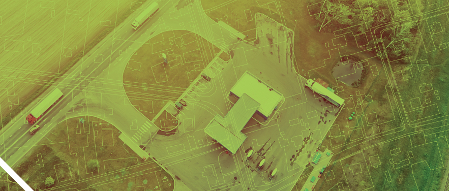
Environmental drillers and geotechnical engineers rely on professional utility locating services to ensure every borehole is placed safely, accurately, and in full compliance with regulations before drilling begins. By identifying both public and private underground utilities — including gas, electric, water, and communication lines — we help prevent costly damage, frustrating project delays, and serious safety risks.
Our capabilities extend beyond standard utility locating. We specialize in detecting and documenting underground storage tanks (USTs), associated product and vent piping, and UST pits — subsurface features that present unique hazards and are frequently encountered on environmental investigation sites. Using ground-penetrating radar (GPR), electromagnetic induction (EMI), and electromagnetic locating instruments, we can identify the presence, approximate boundaries, and orientation of these features even when site records are incomplete or unavailable.
Our precise locating methods give field teams confidence to move forward with soil sampling, monitoring well installation, and subsurface investigations with full confidence — protecting crews, infrastructure, and data integrity while keeping vertical drilling projects on schedule.
Why BLVD?
Hyper-Focused on High Quality: We obsess over the details, going above and beyond the scope of work to locate every line and map every corner. We work in inches, not feet, and take painstaking care in every aspect of our work. This is quality and focus as you’ve never experienced. This is the BLVD way.
Expedited Response Times: We respond to most quote requests within an hour. For more complex scopes, responses may take several hours — at most. Then there’s our speed to market, from streamlined scheduling to getting multiple team members boots on the ground within 1-2 days for urgent projects.
Elevated Experience: Our team members’ average experience is 7.5 years of hands-on utility location. Because our people stay, we continuously invest in developing their capabilities — strengthening quality, safety, and pride in craftsmanship.
Tailored Deliverables: We customize deliverables to align with project scope — right-sizing data without overwhelming stakeholders. This includes GPS mapping on every project, CAD deliverables at no additional charge, and real-time updates and progress reports from the field. Detailed field sketches and reports document tank locations relative to proposed borehole coordinates, giving project teams the information they need to safely position drilling equipment and avoid catastrophic strikes.
Optimal Accuracy: Our uncompromising quality assurance process is designed to achieve 99.9% investigation accuracy. EMI is particularly effective for detecting buried metallic tanks and associated piping, mapping their footprint, and distinguishing them from other subsurface anomalies — all without any ground disturbance.
Trust the Process
While we can adapt our processes as needed, a typical environmental project follows these steps:
-

1. Intake and scope alignment
-

2. Records, Research & Utility Outreach
-

3. Field investigation including real-time GIS capture
-

4. Data integration + QA/QC
-

5. Dissemination of final deliverable(s)
-

6. Ongoing Crew Support
-
Contact:
Josh Dotson
Vice President
(567) 277-1977
jd@blvdus.com
-
"BLVD is our go-to for the best combination of professionalism, responsiveness, cost and reliability. We use them all throughout the U.S. They have made underground utility investigation a low-management effort for us on our projects."Land surveying and remote sensing firm